
Tiedeman Avenue Multimodal Study
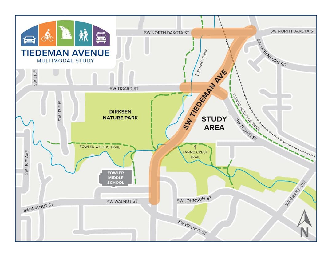
The Tiedeman Avenue Multimodal Study aims to improve the safety, walkability, and connectivity on Tiedeman Avenue from Greenburg Road to Walnut Street, and the surrounding area.
We want to know what transportation improvements would help get you where you need to go, whether walking, bicycling, riding transit or driving.
This study will be guided by community input and will be guided by Tigard’s Strategic Plan and Complete Streets policy, each aimed at supporting equitable access for road users of all ages and abilities. We want to hear from you!
Transportation Needs
Please use this map to tell us what you think are opportunities or challenges for us to consider in the project study area.
Click on the map to begin. Once you have the map open you can click on the (+) button to choose from different PINS.
- GREEN PINS indicate opportunities
- RED PINS indicate challenges
- YELLOW PIN is for telling us anything else we should be aware of
Once you find the PIN that matches your input, drag and drop it on the map. You will have the option to upload a picture and add a comment to tell us more about the area.
